
Archivo:2014 North American polar vortex NOAA map ua nhem 500p.png
Tamaño de esta previsualización: 571 × 600 píxeles. Otras resoluciones: 229 × 240 píxeles · 457 × 480 píxeles · 700 × 735 píxeles.
Ver la imagen en su resolución original (700 × 735 píxeles; tamaño de archivo: 51 kB; tipo MIME: image/png)
Resumen
| Descripción |
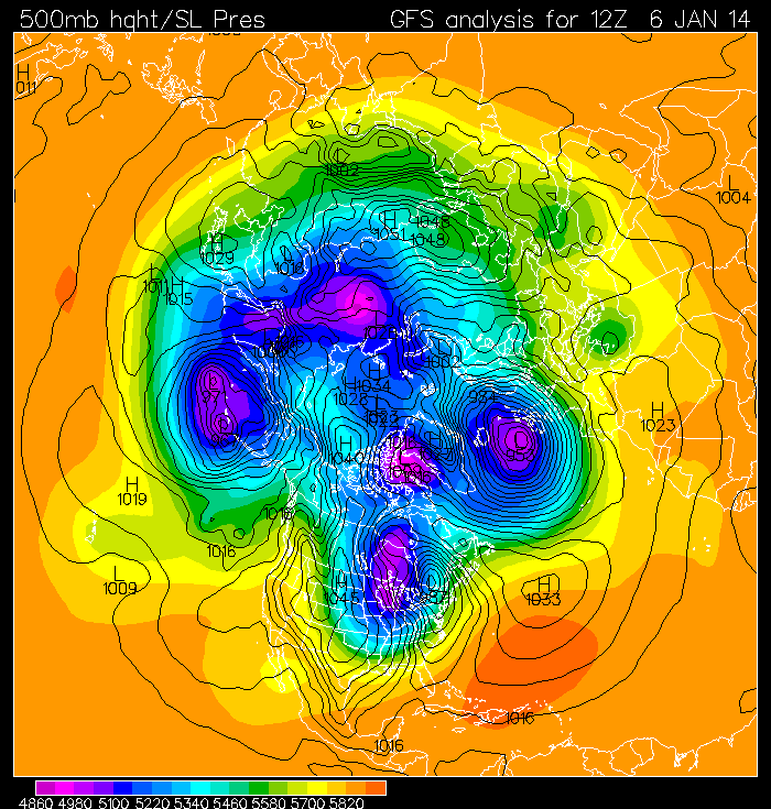
English: The jet stream for January 6, 2014 (pale blue in map to right) follows a wavy pattern over the whole Northern hemisphere, and the path of the jet stream is out of the north over the central U.S., bringing cold air southward from the Arctic and producing record cold temperatures for the eastern half of the U.S.. Regions of light blue color show the counter-clockwise path of the jet stream for January 6, 2014. The map in white near the bottom center shows the outline of the U.S. |
| Fecha | |
| Fuente | http://www.pmel.noaa.gov/arctic/atmosphere/polar_vortex_2014.html |
| Autor | National Oceanic and Atmospheric Administration - Pacific Marine Environmental Laboratory |
Licencia
Esta imagen es de dominio público porque contiene material que vino originalmente de la Administración Nacional Oceánica y Atmosférica de los Estados Unidos de América, recibidas o hechas en el curso de las funciones oficiales de un empleado.
|
Historial del archivo
Haz clic sobre una fecha y hora para ver el archivo tal como apareció en ese momento.
| Fecha y hora | Miniatura | Dimensiones | Usuario | Comentario | |
|---|---|---|---|---|---|
| actual | 14:33 7 ene 2014 | | 700 × 735 (51 kB) | Oaktree b | User created page with UploadWizard |
Usos del archivo
La siguiente página usa este archivo: