
Archivo:National-atlas-pennsylvania.png
No se dispone de una resolución más alta.
National-atlas-pennsylvania.png (762 × 590 píxeles; tamaño de archivo: 140 kB; tipo MIME: image/png)
Resumen
| Descripción |
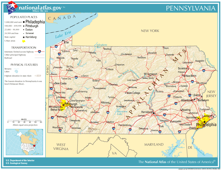
English: Map of Pennsylvania. |
| Fecha | |
| Fuente | National Atlas |
| Autor |
Licencia
This map was obtained from an edition of the National Atlas of the United States. Like almost all works of the U.S. federal government, works from the National Atlas are in the public domain in the United States.
Online access: NationalAtlas.gov | 1970 print edition: Library of Congress, Perry-Castañeda Library
|
Historial del archivo
Haz clic sobre una fecha y hora para ver el archivo tal como apareció en ese momento.
| Fecha y hora | Miniatura | Dimensiones | Usuario | Comentario | |
|---|---|---|---|---|---|
| actual | 19:10 14 oct 2005 | | 762 × 590 (140 kB) | Warden | Reverted to earlier revision |
| 18:19 11 sep 2005 |  | 762 × 590 (140 kB) | Shauni | {{PD-USGov-Atlas}} Category:Maps of Pennsylvania |
Usos del archivo
Las siguientes páginas usan este archivo:
Uso global del archivo
Las wikis siguientes utilizan este archivo:
- Uso en ast.wikipedia.org
- Uso en bn.wikipedia.org
- Uso en ca.wikipedia.org
- Uso en da.wikipedia.org
- Uso en en.wikipedia.org
- Uso en io.wikipedia.org
- Uso en ja.wikipedia.org
- Uso en mk.wikipedia.org
- Uso en mr.wikipedia.org
- Uso en new.wikipedia.org
- Uso en nl.wikipedia.org
- Uso en ru.wikipedia.org