
Archivo:Oga Peninsula and Hachirogata Akita Japan SRTM.jpg

Tamaño de esta previsualización: 608 × 600 píxeles. Otras resoluciones: 243 × 240 píxeles · 486 × 480 píxeles · 681 × 672 píxeles.
Ver la imagen en su resolución original (681 × 672 píxeles; tamaño de archivo: 103 kB; tipo MIME: image/jpeg)
Resumen
| Descripción |
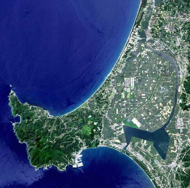
English: Oga Peninsula, Akita, Japan. Hachirōgata is the flat farmland surrounded by water near the base of the peninsula. |
| Fecha | |
| Fuente | image with high-resolution data from Space Shuttle. |
| Autor | user:っ |
| Otras versiones |
|

Licencia
This image uses high-resolution digital topography data from NASA's Shuttle Radar Topography Mission (SRTM) at JPL-Caltech [1]. It is in the public domain in the United States.
|
 | |
Historial del archivo
Haz clic sobre una fecha y hora para ver el archivo tal como apareció en ese momento.
| Fecha y hora | Miniatura | Dimensiones | Usuario | Comentario | |
|---|---|---|---|---|---|
| actual | 05:50 12 ene 2005 | | 681 × 672 (103 kB) | っ | Oga Peninsula, Akita, Japan. Landsat image with high-resolution data from Space Shuttle. {{GFDL-Landsat-Kashmir3d}} {{SpaceShuttle}} |
Usos del archivo
Las siguientes páginas usan este archivo:
Uso global del archivo
Las wikis siguientes utilizan este archivo:
- Uso en ar.wikipedia.org
- Uso en ca.wikipedia.org
- Uso en de.wikipedia.org
- Uso en de.wikivoyage.org
- Uso en en.wikipedia.org
- Uso en fi.wikipedia.org
- Uso en fr.wikipedia.org
- Uso en he.wikipedia.org
- Uso en id.wikipedia.org
- Uso en ja.wikipedia.org
- Uso en ja.wikinews.org
- Uso en ko.wikipedia.org
- Uso en lt.wikipedia.org
- Uso en nl.wikipedia.org
- Uso en pl.wikipedia.org
- Uso en pt.wikipedia.org
- Uso en ru.wikipedia.org
- Uso en th.wikipedia.org
- Uso en tr.wikipedia.org
- Uso en uz.wikipedia.org
- Uso en vi.wikipedia.org
- Uso en www.wikidata.org
- Uso en zh.wikipedia.org