
Archivo:Suffolk UK location map.svg

Tamaño de esta previsualización PNG del archivo SVG: 800 × 520 píxeles. Otras resoluciones: 320 × 208 píxeles · 640 × 416 píxeles · 1024 × 666 píxeles · 1280 × 833 píxeles · 2560 × 1665 píxeles · 1425 × 927 píxeles.
Ver la imagen en su resolución original ((Imagen SVG, nominalmente 1425 × 927 pixels, tamaño de archivo: 1,82 MB))
| Descripción |
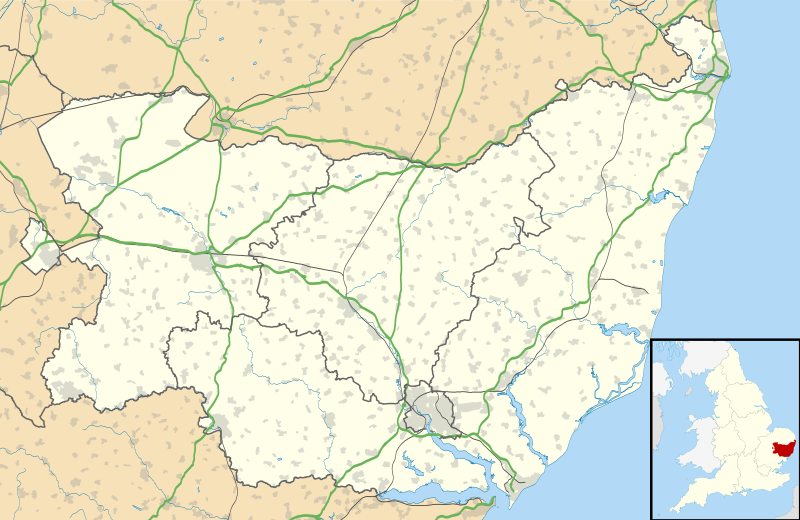
Map of Suffolk, UK with the following information shown:
Equirectangular map projection on WGS 84 datum, with N/S stretched 160% Geographic limits:
|
| Fecha | |
| Fuente |
|
| Autor | Nilfanion, created using Ordnance Survey data |
| Permiso (Reutilización de este archivo) |
Este archivo se encuentra bajo la licencia Creative Commons Genérica de Atribución/Compartir-Igual 3.0. Atribución: Contains Ordnance Survey data © Crown copyright and database right
|
| Otras versiones | File:Suffolk UK district map (blank).svg - Blank map |
.svg)
Historial del archivo
Haz clic sobre una fecha y hora para ver el archivo tal como apareció en ese momento.
| Fecha y hora | Miniatura | Dimensiones | Usuario | Comentario | |
|---|---|---|---|---|---|
| actual | 01:11 31 oct 2019 | | 1425 × 927 (1,82 MB) | The Equalizer | Updated district borders |
| 19:14 26 sep 2010 |  | 1425 × 927 (1,86 MB) | Nilfanion | {{Information |Description=Map of Suffolk, UK with the following information shown: *Administrative borders *Coastline, lakes and rivers *Roads and railways *Urban areas Equirectangular map projection on WGS 84 datum, with N/S stretched 160 |
Usos del archivo
Hay más de 100 páginas que enlazan con este archivo.
La lista siguiente sólo muestra las primeras 100 páginas que enlazan con este archivo. También puedes consultar la lista completa.
- Acton (Suffolk)
- Bacton (Suffolk)
- Badwell Ash
- Bardwell
- Barnby
- Barningham
- Barrow (Suffolk)
- Base Aérea de RAF Lakenheath
- Beccles
- Bentley (Suffolk)
- Beyton
- Bildeston
- Blundeston
- Boxford (Suffolk)
- Bramford
- Brandon (Suffolk)
- Brantham
- Bucklesham
- Bungay
- Capel St Mary
- Carlton (Suffolk)
- Cavendish (Suffolk)
- Chedburgh
- Chelmondiston
- Clare (Suffolk)
- Claydon (Suffolk)
- Coddenham
- Coldfair Green
- Culford
- Debenham
- Drinkstone Green
- East Bergholt
- Edwardstone
- Elmsett
- Elmswell
- Eye (Suffolk)
- Felixstowe
- Fornham All Saints
- Fornham St Martin
- Framlingham
- Fressingfield
- Gazeley
- Gislingham
- Glemsford
- Great Blakenham
- Great Finborough
- Great Waldingfield
- Groton (Suffolk)
- Grundisburgh
- Hadleigh
- Halesworth
- Haughley
- Haverhill (Suffolk)
- Heckfield Green
- Henley
- Hepworth
- Hessett
- Hitcham
- Holbrook (Suffolk)
- Hollesley
- Holywell Row
- Honington Airfield
- Hopton
- Horringer
- Hundon
- Incidente ovni de Rendlesham Forest
- Ipswich
- Ixworth
- Kedington
- Kesgrave
- Kessingland
- Kirton (Suffolk)
- Lakenheath
- Lavenham
- Lawshall
- Laxfield
- Leavenheath
- Lowestoft
- Mendlesham
- Milden
- Mildenhall
- Moulton (Suffolk)
- Nayland
- Needham Market
- Newmarket
- Norton (Suffolk)
- Old Newton
- Onehouse
- Orford (Suffolk)
- Otley (Suffolk)
- Pakenham
- Palgrave
- Red Lodge
- Reydon
- Stanton (Suffolk)
- Stowmarket
- Stowupland
- Stradbroke
- Stratford St Mary
- Tesoro de Hoxne
Ver más enlaces a este archivo.
Uso global del archivo
Las wikis siguientes utilizan este archivo:
- Uso en ar.wikipedia.org
- Uso en ba.wikipedia.org
- Uso en bg.wikipedia.org
- Uso en ceb.wikipedia.org
- Uso en cs.wikipedia.org
- Uso en de.wikipedia.org
- Uso en en.wikipedia.org
- Kesgrave
- Kettlebaston
- Southwold
- Beccles
- Bungay
- Kessingland
- Lowestoft
- Aldeburgh
- Hadleigh, Suffolk
- Sudbury, Suffolk
- Somerleyton
- Herringfleet
- Leiston
- Cavendish, Suffolk
- Framlingham Castle
- Bungay Castle
- Framlingham
- Gipping
- Eye, Suffolk
- Newmarket, Suffolk
- Bury St Edmunds
- Honington, Suffolk
- Norton, Suffolk
- Felixstowe
- Mildenhall, Suffolk
- Needham Market
- Walberswick
- Capel St Mary
- Hintlesham
- Metfield
- Clare, Suffolk
- Reydon
- RAF Lakenheath
- Lakenheath
- Bramford
- Yoxford
- Sizewell
- RAF Honington
Ver más uso global de este archivo.