
Archivo:Devils Tower aerial.jpg
Tamaño de esta previsualización: 800 × 423 píxeles. Otras resoluciones: 320 × 169 píxeles · 640 × 338 píxeles · 1024 × 542 píxeles · 1857 × 982 píxeles.
Ver la imagen en su resolución original (1857 × 982 píxeles; tamaño de archivo: 2,16 MB; tipo MIME: image/jpeg)
Resumen
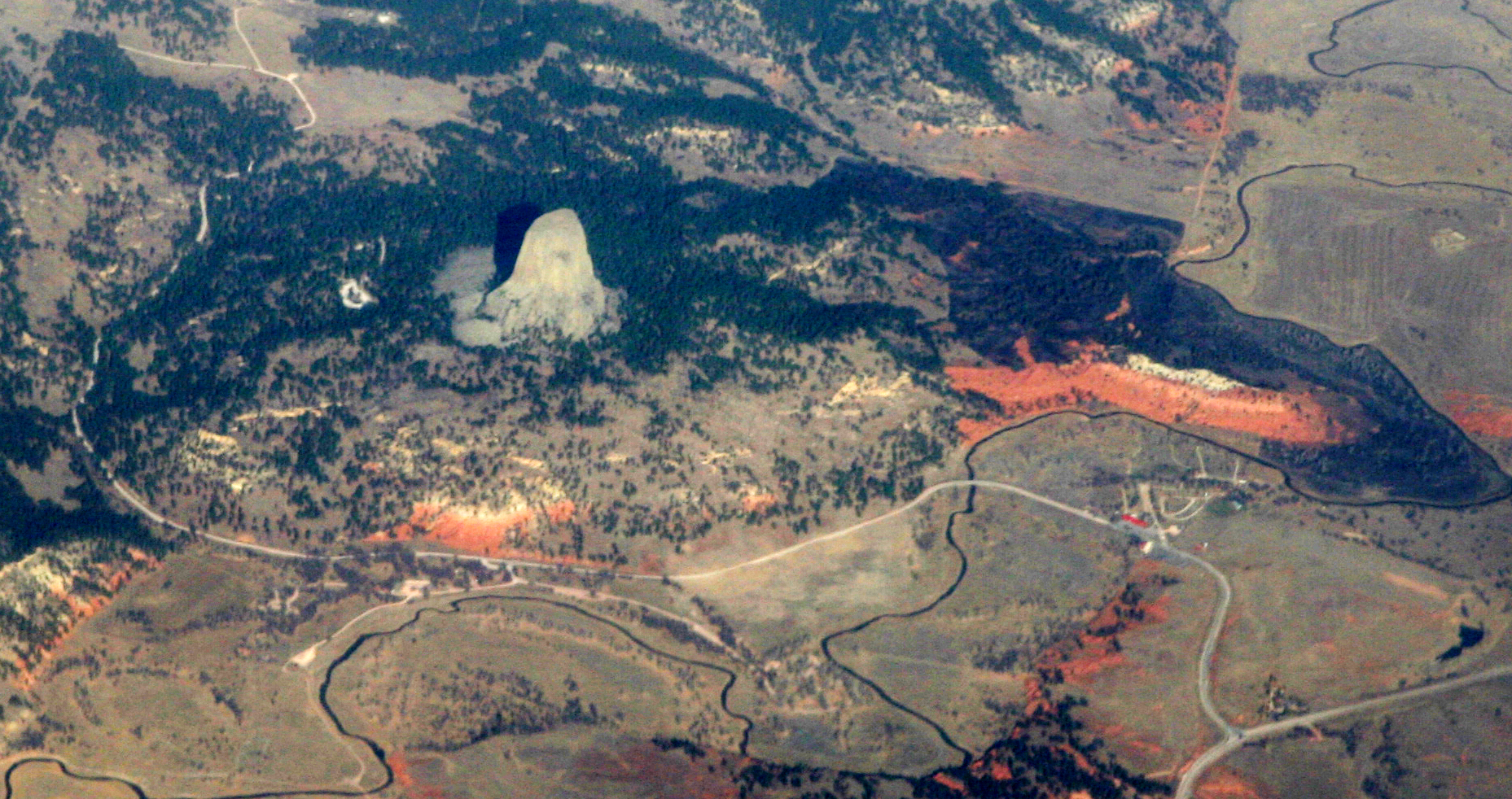
| Descripción | Devils Tower, a national monument in northeastern Wyoming, above the Belle Fourche River. Familiar to most folks as the setting for Close Encounters of the Third Kind, it was known by the Sioux as "Mato Tipila, which means “Bear Lodge”. In fact it is the neck of a long-extinct volcano. The circular shape of the land around it suggests the shape of the volcano itself. While Devils Tower is Tertriary in age (40-some million years old), the rock through which it intruded is a good bit older. The red rock is the Permian-Triassic Spearfish Formation, about a quarter-billion years old. Above it the white layer is of the more recent (Jurassic) Gypsum Spring Formation, which interests me mostly because, like so many other formations in Wyoming, it was named by J. David Love, the great Rocky Mountain Geologist who was the primary human subject of John McPhee's books Rising from the Plains, and Annals of the Former World. |
| Fecha | |
| Fuente |
|
| Autor | Doc Searls from Santa Barbara, USA |
| Posición de la cámara | | Ubicación de esta y otras imágenes en: OpenStreetMap |
|---|
Licencia
Este archivo está disponible bajo la licencia Creative Commons Atribución 2.0 Genérica.
- Eres libre:
- de compartir – de copiar, distribuir y transmitir el trabajo
- de remezclar – de adaptar el trabajo
- Bajo las siguientes condiciones:
- atribución – Debes otorgar el crédito correspondiente, proporcionar un enlace a la licencia e indicar si realizaste algún cambio. Puedes hacerlo de cualquier manera razonable pero no de manera que sugiera que el licenciante te respalda a ti o al uso que hagas del trabajo.
| Esta imagen, originalmente subida a Flickr, fue revisada el December 1, 2010 por el administrador o revisor File Upload Bot (Magnus Manske), quien comprobó que el archivo se encontraba disponible en Flickr bajo la licencia nombrada en dicha fecha. |
Historial del archivo
Haz clic sobre una fecha y hora para ver el archivo tal como apareció en ese momento.
| Fecha y hora | Miniatura | Dimensiones | Usuario | Comentario | |
|---|---|---|---|---|---|
| actual | 01:46 1 dic 2010 | | 1857 × 982 (2,16 MB) | File Upload Bot (Magnus Manske) | {{Information |Description=[http://en.wikipedia.org/wiki/Devils_Tower_National_Monument Devils Tower], a [http://www.nps.gov/deto/ national monument] in northeastern Wyoming, above the [http://en.wikipedia.org/wiki/Belle_Fourche_River Belle Fourche River] |
Usos del archivo
La siguiente página usa este archivo:
Uso global del archivo
Las wikis siguientes utilizan este archivo:
- Uso en an.wikipedia.org
- Uso en ceb.wikipedia.org
- Uso en en.wikipedia.org
- Uso en fa.wikipedia.org
- Uso en fr.wikipedia.org
- Uso en ja.wikipedia.org
- Uso en lld.wikipedia.org
- Uso en sl.wikipedia.org
- Uso en www.wikidata.org