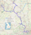
Archivo:Grand Union Canal, complete system map.png
Apariencia

Tamaño de esta previsualización: 532 × 599 píxeles. Otras resoluciones: 213 × 240 píxeles · 426 × 480 píxeles · 682 × 768 píxeles · 909 × 1024 píxeles · 1380 × 1555 píxeles.
Ver la imagen en su resolución original (1380 × 1555 píxeles; tamaño de archivo: 3,29 MB; tipo MIME: image/png)
Historial del archivo
Haz clic sobre una fecha y hora para ver el archivo tal como apareció en ese momento.
| Fecha y hora | Miniatura | Dimensiones | Usuario | Comentario | |
|---|---|---|---|---|---|
| actual | 14:56 4 may 2022 |  | 1380 × 1555 (3,29 MB) | G-13114 | various small improvements |
| 09:44 4 may 2022 |  | 1380 × 1555 (3,29 MB) | G-13114 | add locator map | |
| 23:34 26 abr 2022 |  | 1380 × 1555 (3,37 MB) | G-13114 | Tweaks | |
| 02:18 26 abr 2022 |  | 1380 × 1555 (3,37 MB) | G-13114 | Cropped with improvements | |
| 02:06 26 abr 2022 |  | 1380 × 1660 (3,61 MB) | G-13114 | {{OpenStreetMap |name = |location = |description = Map of the complete system of the Grand Union Canal, including all significant arms and branches. |top = |bottom = |left = |right = |date = 2022-04-26 |authors = Own work, derived from open street map. |other_versions = }} Category:OpenStreetMap maps of the West Midlands (region) Category:OpenStreetMap maps of Warwickshire Category:Maps produced by User:G-13114 Category:Grand Union Canal [[Category:OpenStreetMap maps... |
Usos del archivo
La siguiente página usa este archivo:
Uso global del archivo
Las wikis siguientes utilizan este archivo:
- Uso en en.wikipedia.org

