
Archivo:Palpara Temple - Nadia 2011-10-05 050410.JPG
Ver la imagen en su resolución original (2736 × 3648 píxeles; tamaño de archivo: 4,34 MB; tipo MIME: image/jpeg)
Resumen
| Descripción |
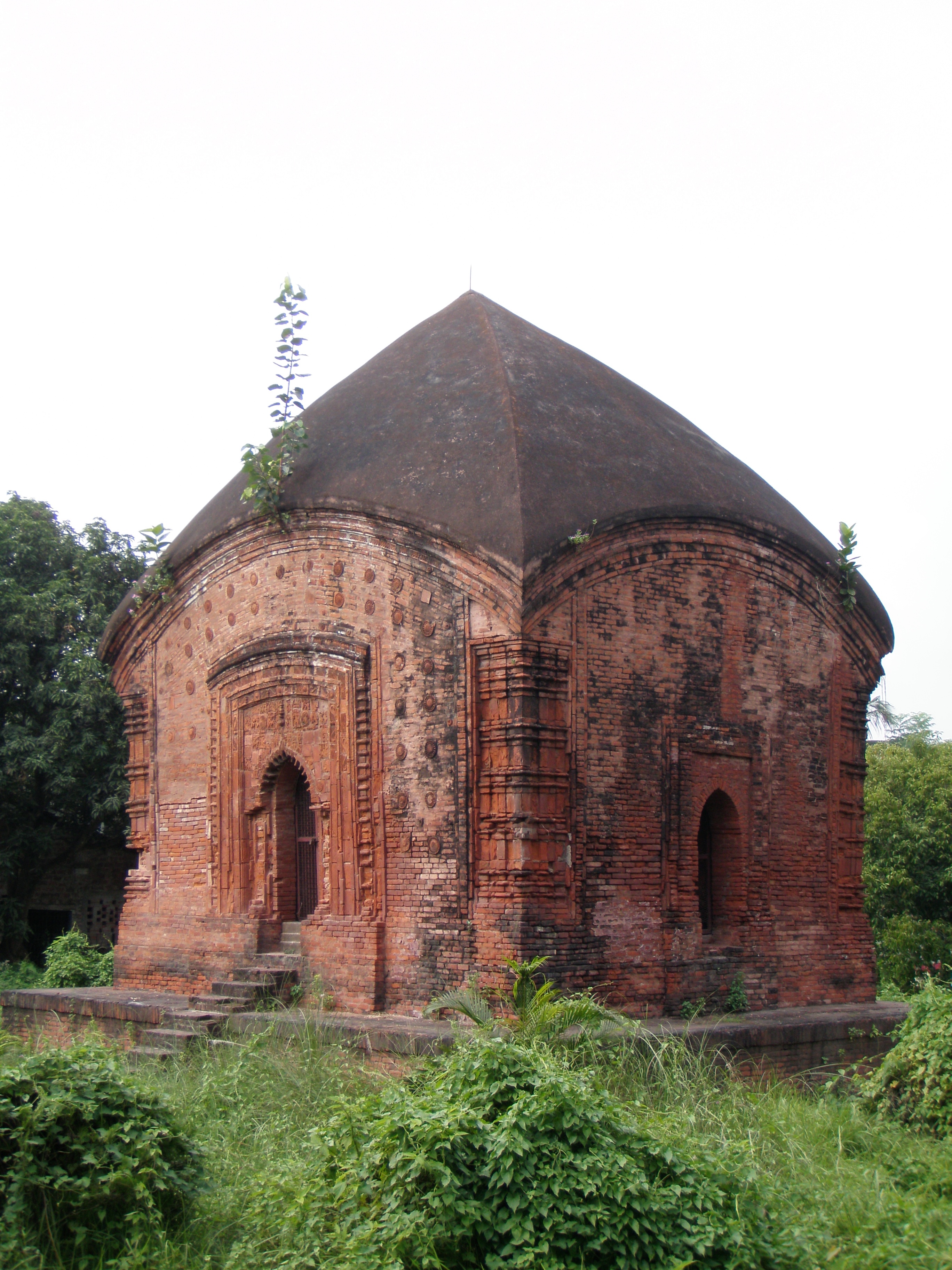
English: The Archeological Survey of India (ASI) describes it as the Palpara temple while the local people call it Math Mandir, Kali Mandir or Shiva Mandir. The 17th century temple, long abandoned, was restored by the ASI and declared a monument of national importance.
The charchala structure (where the four sloped roofs form a pinnacle) made of brick and facing south stands on a raised plinth. It is believed to have been built by Gandharba Roy in the 17th century, although the plaque containing information such as the name of the founder and the year of foundation has long been lost. The temple stands on a square base and is around 21 metres tall. The decorated arched entrance is flanked by brick pillars on either side. The area above the arched entrance once contained intricately carved terracotta panels but most of them have been destroyed by nature and neglect. Scenes from the Ramayana, geometric and floral patterns and the lotus motif are all that remain of the detailed terracotta works that once adorned the walls. There is a panel showing Rama shooting arrows and another in which Ravana is defending himself. Charchala temples are one of the earliest forms of temple architecture in Bengal and only a few of these structures are still standing. With time, the charchala was modified into the aatchala, which consists of a charchala upon a charchala, and is the most common type of temple architecture in Bengal. Located 59km from Calcutta on the Sealdah-Krishnagore railway line, Palpara can be reached in an hour and a half by local train. Although trains are frequently available, for the most comfortable journey take a morning train. Residents of the area might direct you to another temple frequented by devotees, but there’s hardly any history attached to it. The temple is surrounded by a 5ft high wall. A board of the ASI describes it as a monument of national importance. Another board offers a brief history and description of the temple. The complex remains locked and the caretaker can rarely be found. So be prepared to scale the boundary wall. The garden around the temple is overrun with weeds. A narrow pathway leads to the temple, which is usually locked. One cannot enter the sanctum sanctorum of the temple. Although robbed of its former glory and lying in neglect, the Palpara temple provides an insight into Bengal’s early temple architecture. |
| Fecha | |
| Fuente | Trabajo propio |
| Autor | Biswarup Ganguly |
| Posición de la cámara | | Ubicación de esta y otras imágenes en: OpenStreetMap |
|---|
This media file is uploaded with India loves Wikipedia event.
|
Licencia

|
Se autoriza la copia, distribución y modificación de este documento bajo los términos de la licencia de documentación libre GNU, versión 1.2 o cualquier otra que posteriormente publique la Fundación para el Software Libre; sin secciones invariables, textos de portada, ni textos de contraportada. Se incluye una copia de la dicha licencia en la sección titulada Licencia de Documentación Libre GNU. |
- Eres libre:
- de compartir – de copiar, distribuir y transmitir el trabajo
- de remezclar – de adaptar el trabajo
- Bajo las siguientes condiciones:
- atribución – Debes otorgar el crédito correspondiente, proporcionar un enlace a la licencia e indicar si realizaste algún cambio. Puedes hacerlo de cualquier manera razonable pero no de manera que sugiera que el licenciante te respalda a ti o al uso que hagas del trabajo.
Historial del archivo
Haz clic sobre una fecha y hora para ver el archivo tal como apareció en ese momento.
| Fecha y hora | Miniatura | Dimensiones | Usuario | Comentario | |
|---|---|---|---|---|---|
| actual | 00:11 6 oct 2011 | | 2736 × 3648 (4,34 MB) | Gangulybiswarup |
Usos del archivo
La siguiente página usa este archivo:
Uso global del archivo
Las wikis siguientes utilizan este archivo:
- Uso en en.wikipedia.org